Beylagan (Beylagan)
Beylagan (Beyləqan ) is the administrative centre of the Beylagan District of Azerbaijan. During the Soviet era, it was renamed Zhdanov (Жданов) after Stalinist politician Andrei Zhdanov. This move was reverted in 1991 when the city assumed its original name again. Beylagan is one of the oldest towns in Azerbaijan. It is located in the triangle between the Kura and Aras rivers in the Mil plain.
23 industrial enterprises were registered in the Beylagan region. In 2009, industrial enterprises of the region, as well as individuals, produced industrial products by 3.6 million AZN at actual prices. The volume of industrial production was 37% more than in the same period of 2006. Industrial products worth 3.7 million AZN were sent to consumers. Beylagan district is one of the important agricultural regions of the republic. The total area of the district is 113.113 hectares of land. 69.8 percent of the total land area, i.e. 78,920 hectares, are agricultural land. In addition, the area of the region called the "Blue Lake" - National Park 4,142 hectares, the canal and the road to 31,548 hectares of the Araz river bed under the 343 hectares of the border strip, including 37.213 hectares of land, there are lands of the state fund. Grain, cotton and livestock are the main areas of the region's economy. In addition, the farms grow potatoes, grapes, vegetables, melons and fruits. In 2010, the number of cattle in the region was 55,000 head, and the number of cattle was 290,000. During the year, 34,800 tons of milk were produced in the region.
23 industrial enterprises were registered in the Beylagan region. In 2009, industrial enterprises of the region, as well as individuals, produced industrial products by 3.6 million AZN at actual prices. The volume of industrial production was 37% more than in the same period of 2006. Industrial products worth 3.7 million AZN were sent to consumers. Beylagan district is one of the important agricultural regions of the republic. The total area of the district is 113.113 hectares of land. 69.8 percent of the total land area, i.e. 78,920 hectares, are agricultural land. In addition, the area of the region called the "Blue Lake" - National Park 4,142 hectares, the canal and the road to 31,548 hectares of the Araz river bed under the 343 hectares of the border strip, including 37.213 hectares of land, there are lands of the state fund. Grain, cotton and livestock are the main areas of the region's economy. In addition, the farms grow potatoes, grapes, vegetables, melons and fruits. In 2010, the number of cattle in the region was 55,000 head, and the number of cattle was 290,000. During the year, 34,800 tons of milk were produced in the region.
Map - Beylagan (Beylagan)
Map
Country - Azerbaijan
 |
 |
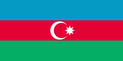
| Flag of Azerbaijan | |
The Azerbaijan Democratic Republic proclaimed its independence from the Transcaucasian Democratic Federative Republic in 1918 and became the first secular democratic Muslim-majority state. In 1920, the country was incorporated into the Soviet Union as the Azerbaijan SSR. The modern Republic of Azerbaijan proclaimed its independence on 30 August 1991, shortly before the dissolution of the Soviet Union in the same year. In September 1991, the ethnic Armenian majority of the Nagorno-Karabakh region formed the self-proclaimed Republic of Artsakh. The region and seven surrounding districts are internationally recognized as part of Azerbaijan pending a solution to the status of the Nagorno-Karabakh through negotiations facilitated by the OSCE, although became de facto independent with the end of the First Nagorno-Karabakh War in 1994. Following the Second Nagorno-Karabakh War in 2020, the seven districts and parts of Nagorno-Karabakh were returned to Azerbaijani control.
Currency / Language
| ISO | Currency | Symbol | Significant figures |
|---|---|---|---|
| AZN | Azerbaijani manat | ₼ | 2 |
| ISO | Language |
|---|---|
| HY | Armenian language |
| AZ | Azerbaijani language |
| RU | Russian language |


